Seychelles vs Comoros: 8 Ways Indian Ocean Islands Differ
"When you finally feel the breath of the land that a map cannot describe, that is when the true journey begins."
Exploring the Indian Ocean means understanding that no two islands are created equal. Some rise from the depths as massive granite monuments, while others are born from the fiery pulse of volcanoes.
* Understand the fundamental difference between Seychelles' granite landscapes and Comoros' volcanic terrain. * Identify the strategic geographic positioning between Madagascar and the African continent. * Recognize how altitude and rainfall create diverse microclimates within a single island. * Use topographical knowledge to build a more efficient travel itinerary.
Where is this Indian Ocean paradise located and how was it formed?
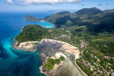
The morning sun hits the cockpit window, and as the plane dips through a layer of clouds, massive granite boulders emerge from the turquoise sea like sleeping giants. It looks less like a beach and more like a prehistoric sculpture rising from the depths.
In the early morning light of 2026, looking down from a flight, you realize these aren't just sandbars. The massive granite formations lining the coast tell a story of a world shaped by shifting continents.
As the plane descends toward Mahé, the lush greenery clinging to the steep slopes becomes visible, proving this is much more than a simple tropical getaway.
According to The World Factbook of the Central Intelligence Agency, as of 2018, 95.9% of the population aged 15 and over can read and write in the Seychelles.
The archipelago is situated in the Somali Sea segment of the Indian Ocean. It lies north of Madagascar and is approximately 1,600 km (860 nmi) east of Kenya. The largest island, Mahé, is located about 1,550 km (835 nmi) from Mogadishu.
The geography of the Seychelles goes far beyond pretty postcards; it is a living record of Earth's history. Formed as fragments of a continent drifted away, these islands feature unique granite landscapes that set them apart from almost any other island group in the world.
This specific geology is what created the dramatic, boulder-strewn shores of places like Anse Source d'Argent.
The climate on Mahé is as dynamic as its terrain. Temperatures generally fluctuate between 24 to 30 °C (75 to 86 °F). While the Victoria area sees an annual rainfall of about 2,900 mm (114 in), the rainfall on the mountain slopes can reach as high as 3,600 mm (142 in).
This heavy precipitation is the lifeblood that keeps the islands' interior so vibrantly green.
How do the Seychelles differ from the Comoros?
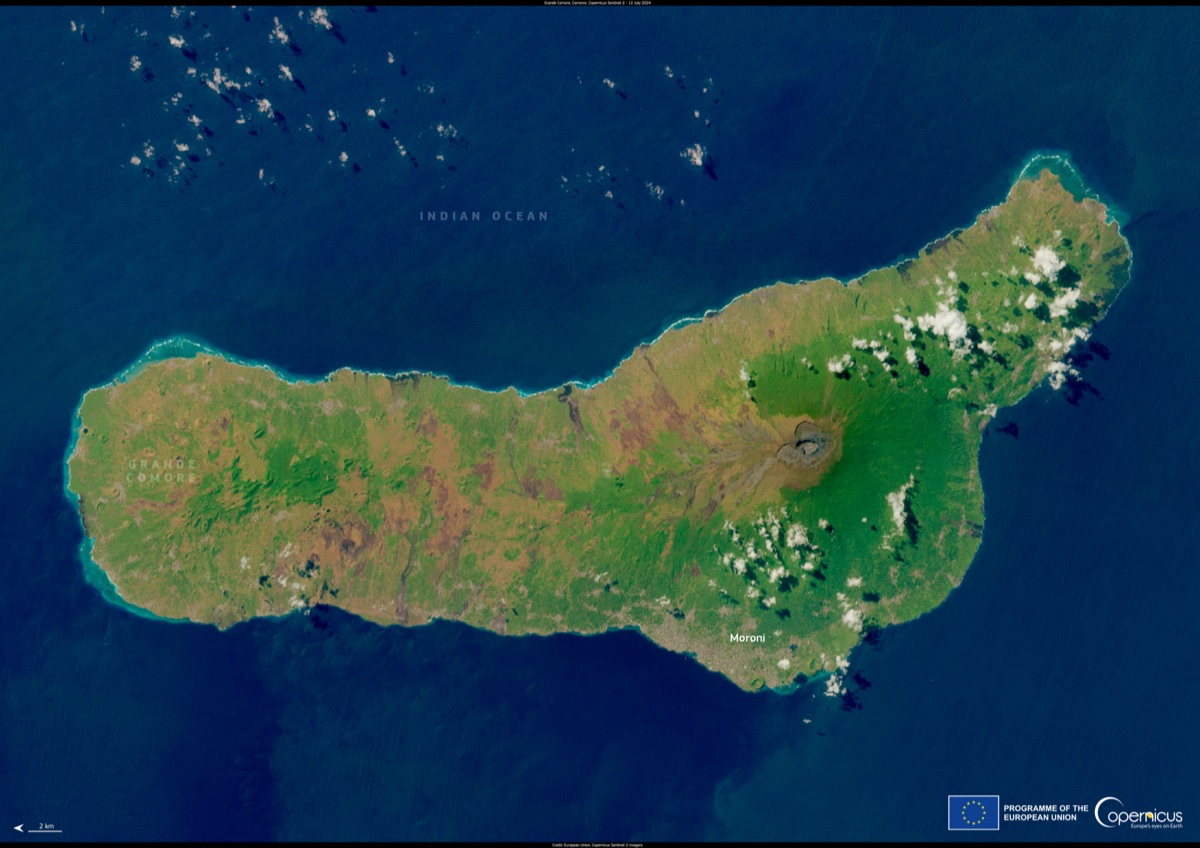
If you were to draw a line on a map connecting these scattered dots of land, you would see two very different worlds. While the Seychelles feels like a secluded sanctuary in the heart of the ocean, the Comoros archipelago feels much closer to the shadow of the African continent.
The primary difference lies in geological origins and placement. The Seychelles consists of granite-based islands formed from continental fragments, whereas the Comoros are volcanic islands.
This distinction changes everything: the shape of the coastlines, the quality of the soil, and the types of vegetation that grow there.
Geography also dictates how these nations interact with their neighbors. Because the Seychelles is positioned in the vast expanse of the Indian Ocean north of Madagascar, it developed a highly unique and isolated ecosystem.
In contrast, the Comoros sits in a position where the influence of the African mainland is much more direct.
For a traveler, these geological differences translate into vastlyly different visual experiences. The massive, smooth granite boulders of the Seychelles offer a sharp contrast to the rugged, volcanic slopes of the Comoros, showcasing the diverse faces of the Indian Ocean.
But how do these geological differences actually change your day-to-day experience on the ground?
Comparing the geography of Indian Ocean islands
Knowing the topographical layout of an island before you arrive changes how you appreciate the view. The following table summarizes the key geographic elements of the Seychelles.
| Feature | Seychelles Geographic Characteristic | Notes |
|---|---|---|
| Primary Terrain | Massive granite and mountainous landscapes | Characteristic of Mahé |
| Location | Somali Sea, Indian Ocean (North of Madagascar) | ~1,600 km east of Kenya |
| Climate Profile | High rainfall in mountainous areas (up to 3,600 mm) | Creates various microclimates |
| Geological Origin | Continental fragment granite islands | Distinct from volcanic Comoros |
The islands within the Seychelles vary significantly in size and character. Some islands are dominated by rugged mountain ranges, while others offer low-lying, sweeping beaches. This internal variety is the heart of the Seychelles experience.
Understanding the geographic context for travelers
Sitting on a beach in the heat of a 2025 summer, you feel the warm sand sliding between your toes. The ocean looks crystal clear, but the distant mountain ridges look solid and eternal, as if time stood still.
According to World Bank data, Seychelles recorded international tourist arrivals of 124,500 in 2020.
When traveling through the Seychelles, it is vital to look beyond the shoreline. Moving through the mountainous terrain of Mahé reveals lush tropical rainforests that look entirely different from the coastal areas. This is due to the heavy rainfall caused by the rising air over the high elevations.
In contrast, islands like Praslin or La Digue are relatively flat or consist of low hills. Understanding this difference explains why the beaches and plant life vary so much from one island to the next.
Planning travel between islands requires careful consideration of distance. Even within the Seychelles, the gaps between islands vary, which impacts whether you should rely on ferries or small propeller planes. Rugged terrain can also make travel times much longer than they appear on a flat map.
But what happens when the weather turns?
How terrain and climate create travel variables
A sudden downpour hits. The sky turns charcoal gray, and clouds roll down the mountainsides, swallowing the entire island in mist. But when the rain stops, the sunlight feels even more brilliant.
The terrain of the Seychelles is a major driver of local weather. On islands with significant elevation, temperature and rainfall can change drastically depending on how high you climb. This is a crucial factor when deciding what to pack or which hiking trails to tackle.
Additionally, seasonal trade winds in the Indian Ocean determine which sides of the islands have calm waters and which have heavy surf. Understanding the relationship between geography and wind can help you predict the best time to visit specific beaches.
| Factor | Impact | Travel Tip |
|---|---|---|
| Altitude Changes | Temperature and rain shifts between coast and mountains | Pack light layers and waterproof gear |
| Coastline Shape | Wave intensity and beach stability | Check seasonal wind directions |
| Inter-island Distance | Travel methods and time requirements | Pre-check ferry and flight schedules |
A checklist for a successful island trip
Once you understand the terrain, you need a concrete plan. Based on my own experiences moving between these islands, I have put together a list of preparation steps to account for these geographic variables.
- Identify island terrain: Determine if your destination is a mountainous granite island (like Mahé) or a low-lying beach island (like La Digue).
- Book appropriate transport: Choose between small planes for speed or ferries for a more budget-friendly transition between islands.
- Pack for altitude: In addition to light beachwear, always bring a light jacket to handle the temperature drops in higher elevations.
- Prepare for rain: Given the high rainfall in mountainous areas, bring waterproof shoes and water-resistant bags.
- Monitor local weather: Check the daily weather and wind reports at your accommodation to decide on your daily beach or hiking activities.


Comments 0